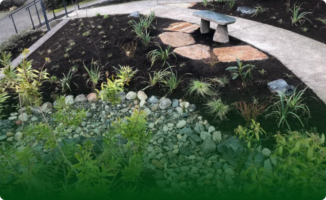

When you inherit a mature garden obscured by years of unmanaged growth, the immediate instinct is often subtraction. A thicket of overgrown shrubs, tangled vines, and sprawling groundcovers can feel like chaos that requires a chainsaw, a weed trimmer, and a rented dumpster.
Clearing everything down to bare dirt erases vital information. A mature, neglected landscape holds the structural history of your property. Beneath the superficial mess lies an established ecosystem: soil biology that took decades to build, root networks that quietly stabilize slopes during wet Puget Sound winters, and mature canopy trees that buffer summer heat.
Stripping a site bare before understanding it almost always creates new, expensive problems. Exposed subsoil erodes under Seattle rains. Sun-loving weeds colonize the freshly disturbed earth within weeks. Plants that provided privacy, wind protection, or seasonal drainage control disappear before you even knew they were working.
Before you remove a single branch or haul away a yard of material, establish a calm, reversible assessment. Your goal during this early window is not to execute a redesign. It is simply to record what is there, distinguish municipal obligations from aesthetic choices, and protect existing assets while you decide what comes next.
Separating Municipal Obligations from Garden Choices
Before you start cataloging plants, separate urgent property-boundary requirements from ordinary garden decisions. You do not need to tackle the whole yard at once, but you do need to make sure your overgrown property is not encroaching on the public right-of-way or blocking essential access.
+-----------------------------------------------------------------------+
|                        GARDEN ASSESSMENT TRIAGE                       |
+------------------------------------+----------------------------------+
| IMMEDIATE ATTENTION                | DEFER FOR OBSERVATION            |
| (Access & Compliance)              | (Ecological & Design Value)      |
+------------------------------------+----------------------------------+
| * Sidewalk clearance (8' overhead) | * Mature trees and large shrubs  |
| * Roadway clearance (14' overhead) | * Unidentified groundcovers      |
| * Blocked sightlines at driveways  | * Thick plant masses on slopes   |
| * Hidden utility meters or pipes   | * Old rockeries and retaining    |
| * Vegetation contacting house siding|  structures                      |
+------------------------------------+----------------------------------+
The City of Seattle regulates physical encroachments into public rights-of-way. If overgrown vegetation extends across the sidewalk, hangs low over a pedestrian corridor where current City guidance may set clearance requirements, or obstructs line-of-sight at an intersection or driveway, address that immediately. Similarly, dense brush that buries utility meters, blocks sewer cleanouts, or rests directly against wooden house siding warrants immediate, surgical clearance.
Keep these urgent interventions narrow. Prune only what is necessary to restore safe passage, prevent structural moisture intrusion, or meet city right-of-way rules. Do not turn a targeted sidewalk trim into a weekend-long clearcut of the front yard. The rest of the garden—no matter how messy it looks from the kitchen window—can wait.
Creating a Baseline Site Record
A reliable site record keeps you from making impulsive, permanent mistakes. You do not need professional surveying tools to build an effective baseline; a smartphone camera and a simple notebook will do the job.
1. Document Wide-Angle Context
Walk the perimeter of the property and take broad, contextual photos from consistent vantage points:
* Stand at each corner of your lot and shoot diagonal frames toward the house.
* Take head-on shots of every building elevation from property lines.
* Photograph the transitions where your yard meets neighboring fences, driveways, and alleyways.
Avoid taking only close-up photos of pretty leaves or gnarly tangles. Wide shots record spatial relationships that your memory will distort once plants are cut back.
2. Divide the Lot into Practical Zones
Group the garden into four or five intuitive working zones based on how you interact with the land:
* The Street Frontage: The interface with public space, parking, and sidewalks.
* Side Corridors: Narrow utility zones, storage spaces, and pedestrian passages.
* Primary Living Areas: Patios, decks, or flat areas adjacent to main living spaces.
* The Back Perimeter: Boundaries, fence lines, and areas adjoining neighbors or greenbelts.
* Slopes and Terraces: Any grade changes requiring steps, rockeries, or retaining walls.
3. Note Fixed Hardscape and Grade Changes
Walk each zone with an eye for structural elements buried under vegetation. Probe gently with a walking stick or the toe of a boot. Look for:
* Sunken stone steps, flagstone pathways, or old brick walkways hidden beneath moss and leaf duff.
* Rockeries, concrete bulkheads, or timber retaining walls holding back terraces.
* Buried downspouts, French drain outlets, or shallow utility lines.
4. Flag Seasonal Unknowns
A landscape in November looks entirely different than it does in May. Deciduous trees that appear dead during winter dormancy might provide your primary summer privacy screen. Bare patches of rich soil might harbor dormant native trilliums, legacy hostas, or spring bulbs. Note open ground, unidentifiable woody crowns, and dense shaded thickets as “seasonal unknowns” on your sketch. Mark them for observation across the coming months rather than writing them off as empty space.
Reading Root Zones, Drainage, and Retaining Structures
An overgrown garden functions as a working structural system. Before subtracting plant material, inspect how the roots, soils, and grade work together across the site.
       TYPICAL CRITICAL ROOT ZONE (CRZ) AWARENESS

                [   DENSE CANOPY   ]
                       |      |
             +---------+------+---------+
             |                          |
    ================================================== (Soil Line)
             |      /   Root Plate   \   |
             |     /                  \  |
             +----+--------------------+ +
                  <-- Critical Root Zone -->
                  (Avoid heavy equipment,
                   soil stripping, or compaction)
Mature Trees and the Critical Root Zone
Mature trees are the most valuable, irreplaceable elements on an urban lot. They are also sensitive to sudden changes in their growing environment. In Seattle, private-property tree removal is strictly governed by municipal tree protection regulations (enforced by the Seattle Department of Construction and Inspections, or SDCI). These rules establish tiered protections based on trunk diameter, species, and whether the lot sits in an Environmentally Critical Area (ECA).
Beyond legal restrictions, mature trees have extensive critical root zones that usually extend well past their drip lines. Heavy equipment brought in for a “quick cleanup”—such as skid steers, mini-excavators, or large woodchippers—compacts the soil, crushing feeder roots and suffocating the tree. Stripping thick ivy or dense groundcover with mechanical tools can strip bark from structural root flares. Hand-snip vines around tree bases instead of tearing them off, and keep heavy wheels off the soil beneath tree canopies.
Drainage Traces and Winter Hydrology
Seattle’s maritime climate delivers long, steady pulses of winter rain over dense glacial till. Over decades, water carves specific paths across an urban parcel. Look closely for the traces water leaves behind:
* Channels of dark, fine-textured sediment gathered at low spots.
* Patches of dense moss, horsetail, or buttercup that indicate prolonged standing saturation.
* The outfalls of roof drainage pipes, which may terminate in drywells, pop-up emitters, or simply open onto the ground.
Dense vegetation can obscure how water moves through a low area. Record wet-season conditions before clearing so that changes in ponding or downslope flow are not mistaken for an unrelated problem later.
Retaining Features and Slope Stability
Many Seattle lots feature steep slopes or historic terracing. Rockeries, dry-stacked stone walls, and old cedar retaining walls are frequently cloaked in English ivy, Himalayan blackberry, or climbing nightshade.
Do not pull down heavy, tangled growth from a retaining wall without looking closely at its structural state. Roots often penetrate the voids between stones. In some cases, the root network is the only thing pinning loose rocks in place; in others, growing trunks are levering stones out of plumb. Note the condition of the wall, check whether soil is weeping through the joints, and determine whether clearing the vegetation will compromise the structural stability of the slope.
The Three-Bucket Plant Inventory
You do not need to identify every plant in the yard on day one. Trying to classify hundreds of dormant, overgrown, or leaf-stripped specimens creates analysis paralysis.
Instead, sort what you see into three operational buckets.
+-------------------------------------------------------------------------------+
|                         THE THREE-BUCKET INVENTORY                            |
+---------------------+-------------------------+-------------------------------+
| BUCKET 1: KNOWN     | BUCKET 2: UNKNOWN       | BUCKET 3: SUSPECTED INVASIVE  |
+---------------------+-------------------------+-------------------------------+
| Clear identity      | Uncertain taxonomy      | Highly aggressive habit       |
| Documented value    | Dormant status          | Regulated or noxious status   |
| Immediate retention | Observe across seasons  | Verify species before cutting |
+---------------------+-------------------------+-------------------------------+
Bucket 1: The Knowns
These are plants you recognize with absolute certainty that clearly provide value to the property:
* Heritage plantings: Mature Japanese maples, specimen camellias, magnolias, or historic rhododendrons.
* Robust native understory: Established western sword ferns, salal, ocean spray, or vine maples.
* Productive landscape elements: Healthy fruit trees, established blueberries, or structural hedges that provide effective screening.
Leave these plants alone for now. Do not reshape them, do not dig around their roots, and resist the urge to perform heavy renovation pruning until you understand their seasonal flowering cycles and health.
Bucket 2: The Unknowns
This bucket holds everything else that is not actively invading or causing harm:
* Deciduous woody shrubs without leaves, flowers, or fruit.
* Masses of herbaceous foliage that could be valued perennials or common weeds.
* Healthy-looking saplings whose mature canopy sizes are unclear.
Tag these plants with surveyor’s tape or mark their locations on your sketch. The operational rule for this bucket is patient deferral. Wait for them to bud out, flower, or display autumn color before deciding whether they belong in the future garden.
Bucket 3: The Suspected Invasives
King County and the City of Seattle face relentless pressure from invasive, non-native plants that disrupt local ecosystems and outcompete cultivated gardens. Common invaders include English ivy, Himalayan and cutleaf blackberry, cherry laurel, knotweed, and creeping bindweed.
However, observation is not identification. It is vital to accurately identify an invasive plant before removal rather than cutting first and researching later.
Certain species respond aggressively to mechanical disturbance. For instance, Japanese knotweed produces vigorous new shoots from microscopic root fragments if it is rototilled or pulled carelessly, and hedge bindweed spreads aggressively from snapped rhizomes. King County Noxious Weed Control guidance highlights that successful management depends entirely on the specific life cycle and reproductive strategy of the weed in question.
Before you hack at a massive patch of green:
1. Photograph the leaf arrangement, stems, and any persistent flowers or berries.
2. Verify whether it is an aggressive invasive or a lookalike native (for example, native trailing blackberry versus non-native Himalayan blackberry).
3. Check county weed boards for species-specific management recommendations that avoid spreading root fragments or seeds across your site.
Determining Your Next Move
Once you have documented the site, cleared public hazards, and grouped your plants into the three buckets, your initial assessment is complete. You have created a workable baseline without destroying existing ecological or structural assets.
From here, you have three practical paths forward:
                  CHOOSE YOUR OPERATIONAL POSTURE
                                 |
         +-----------------------+-----------------------+
         |                                               |
[ Four-Season Watch ]                     [ Phased Targeted Work ]
 * Complex site                          * High-confidence areas
 * Unclear drainage/sun                   * Clear invasive targets
 * Unidentified perennials                * Non-structural projects
                                 |
                    [ Professional Analysis ]
                     * Steep slopes / ECAs
                     * Tree canopy decisions
                     * Comprehensive redesign
- Adopt a Four-Season Watch: If the site is functionally safe, the house is protected, and municipal pathways are clear, the best move is often to do almost nothing for the first year. Living through four seasons on the property reveals where water collects in January, where the soil bakes in July, where the primary privacy sightlines lie, and what emerges from the soil as the months unfold.
- Defer Removal Planning: Even when a plant appears to dominate an area, defer removal planning until its identity and the site constraints around it are clear.
- Initiate Site-Specific Planning: If your property involves steep slopes, mature tree canopies governed by city codes, failing retaining walls, or a complex water table, broad-brush gardening will lead to frustration. When mature trees, complex grades, changing water patterns, or aging structural features make a clearing decision consequential, professional site planning and analysis helps establish clear priorities and a workable sequence before physical labor begins.
Taking the time to record, observe, and categorize an overgrown landscape shifts your posture from reactive clearing to intentional stewardship. The plants and structural elements that have survived years of neglect have proven their resilience; give them a chance to show you what they have to offer before you pull them out.