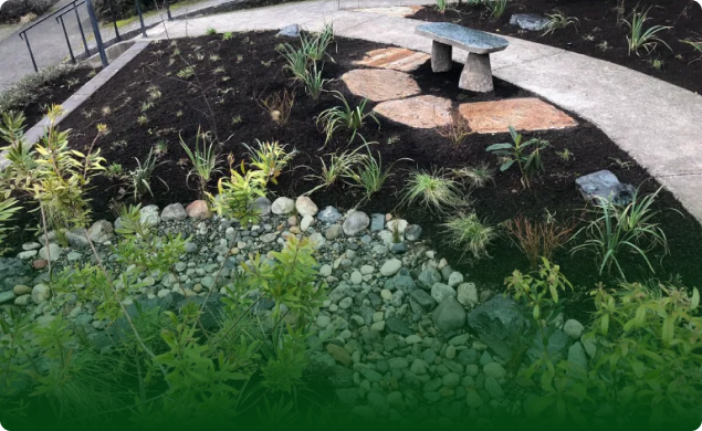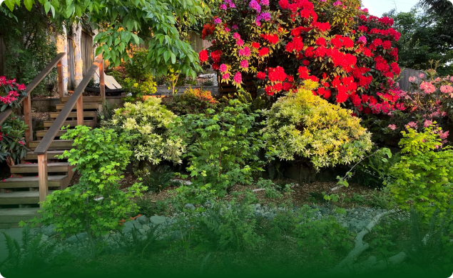
A useful Vashon landscape plan begins with the property itself. Record how people and materials can reach the work area, which trees already occupy it, and what water does when you can observe it safely.
These facts create a design brief grounded in one parcel. They also expose questions that need records, qualified assessment, or a site visit before anyone selects plants or plans construction.
Start with the Particular Vashon Property
Begin with a base map of the area you want to change. Mark buildings, doors, gates, paths, stairs, fences, planting beds, paved surfaces, and visible grade changes. Add a north arrow and a few measurements taken from safe, accessible points.
Label observations, goals, and unverified questions separately. For example, “water crossed the east path during rain” is an observation. “Keep this route open for a wheelbarrow” is a goal. “Confirm the property line” remains an open question.
Photograph the same views from the house toward the yard and from the yard toward each entrance. Date the images. A second set from another season may show changes in shade, vegetation, use, or visible water movement.
The Vashon Island ecological landscaping hub explains Rutheo Designs’ broader local work. Your parcel record supplies the details that a location page cannot establish.
Record Access and Staging Constraints
Walk the route that people, tools, plants, and materials would use. Measure gates, side passages, stairs, tight turns, and overhead clearances that you can reach safely. Photograph thresholds and changes in surface or elevation.
Next, mark possible work and storage areas as questions rather than commitments. Note the space each area occupies today and how the household uses it. Keep emergency routes, daily entrances, and areas outside the project visible on the map.
Record what you know about deliveries or material removal for this project. Leave vehicle size, loading location, delivery timing, and transport methods open until the people doing the work confirm them. A contractor can then plan around measured access instead of a guessed route.
Show nearby trunks, low branches, planted beds, walls, and any surface that needs protection. Keep utilities unresolved until current records and appropriate marking services verify them. An access note should avoid predicting damage or promising that a particular machine can enter.
Inventory Existing Trees Before Design Decisions
Plot each visible trunk and number it on the base map. Photograph the full tree from more than one safe viewpoint. Add the canopy edge you can observe from the ground and note where branches extend above paths, roofs, planting areas, or the proposed work zone.
Record species only when identification is reliable. Otherwise, photograph leaves, buds, bark, cones, flowers, fruit, or growth habit as available. Label uncertain entries as possible identifications and retain the original photographs for later review.
Map roots only where they are visible. Note paving, soil disturbance, irrigation components, walls, or existing construction near the tree without inferring what lies underground. The inventory should help the design respond to existing trees, not turn surface observations into a root-zone conclusion.
Tree Condition Requires On-Site Assessment
Photographs can document a broken limb, cavity, lean, sparse canopy, wound, or visible change. They cannot establish tree health, structural stability, likelihood of failure, or a safe work method.
Keep tree concerns in an assessment list. Include the tree number, photograph date, visible observation, and nearby people or structures. An appropriately qualified tree professional should examine condition and risk on site before pruning, removal, construction near roots, or other consequential work.
Avoid attaching a hazard label to a remote image. When an observation raises an immediate safety concern, keep people away from the area and contact the appropriate qualified professional or emergency authority.
Ask How Water Reaches and Moves Through the Site
King County describes the Vashon-Maury aquifer system as replenished by precipitation. The county also presents rain, groundwater, streams, ponds, runoff, and plant use as parts of an interconnected island hydrologic system.
That official context explains why early landscape planning should account for water. It does not reveal how water is supplied to a particular home or how rain behaves on its parcel.
During ordinary rain, observe from stable ground. Mark where water first appears, the route it follows, where it gathers, and where it leaves the area you can see. Take matching photographs during the rain and after it stops.
Add roof edges, downspouts, paved surfaces, planted areas, and visible discharge points to the map. Record times for the start of rain, visible flow, ponding, and drying when you can do so safely. Describe what happened without assigning a cause.
Plant-water questions also begin with evidence. Record current irrigation components, known operating schedules, and observed plant response only when that information is available. Leave future irrigation and plant selection open until the design has verified site conditions and maintenance capacity.
Wells, Runoff, and Infiltration Need Parcel-Specific Evidence
Start by confirming the actual water information for this property through current records and qualified review. If a documented well serves the parcel, record the verified facts relevant to the project. For another supply arrangement, document that arrangement instead.
The same discipline applies to runoff and infiltration. Water disappearing from view does not prove that it infiltrated at that spot. Ponding does not identify soil type, subsurface conditions, or the right response.
King County measures water quantity and quality indicators across multiple locations and water-bearing zones. Its current framework includes groundwater levels, infiltration, water use, and water quality. Those island-scale indicators support careful water planning, while the varied monitoring locations reinforce the need for parcel evidence.
Keep wells, septic components, soil, slopes, drainage connections, shoreline or critical-area status, permits, and utilities as unresolved questions until current evidence answers them. The relevant records, agencies, and qualified professionals depend on the exact parcel and proposed work.
Protect the Ecological Context in the Design Brief
An ecological brief begins with what is already present. Mark vegetation you want to retain, areas of continuous soil cover, observed wildlife use, and places where construction could disturb plants or soil. Record uncertainty rather than filling it with a generic island description.
List the experiences the landscape should support. These may include habitat, seasonal interest, food growing, gathering, privacy, play, or easier maintenance. Pair each goal with the space, access, and care it would require on this property.
Use the tree and water records to reduce avoidable disturbance. The design can compare routes, work areas, and planting locations against verified site facts before committing to them. Plant choices should follow observed light, moisture, space, mature size, and maintenance conditions.
Protect retained soil, plants, habitat, and water relationships through prevention and site diagnosis. Match plants to the verified conditions, then use ecological or least-toxic care supported for the identified problem. The Vashon brief excludes homemade toxic treatments, toxic fertilizers, and toxic chemical herbicide or pesticide use.
When to Schedule a Vashon Site Review
Schedule a site review before plant selection or construction when the plan depends on unresolved access, existing-tree, water, or parcel questions. Review should also precede work that could affect mature trees, move soil, change water flow, or require verified boundaries, utilities, or jurisdictional requirements.
Bring the base map, access measurements, photographs, tree inventory, rain observations, goals, and open questions. Separate verified facts from assumptions. This gives the designer a concise record to inspect and correct on site.
The Vashon Island Design & Planning pathway connects that record with an ecological landscape review. A site review can then respond to the property that exists, the way you want to use it, and the evidence still needed.
CTA: Schedule a Vashon Island Design & Planning site review with Rutheo Designs. Bring your property map, access measurements, tree photographs, water observations, and unresolved parcel questions.